Radio Horizon
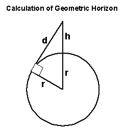
h=Height of aerial above sea level
r=Radius of the earth (3440 Nautical miles)
d=Distance to Horizon
Using Pythagoras d²=(r+h)²-r²
hence d=√((r+h)²-r²)
Radio Horizon
To calculate the Radio Horizon because of refraction we achieve this by pretending the Earth has a larger radius which we call the equivalent Earth radius Re which is normally 4/3r in the UK (4587 NM).There are 6076 feet in a Nautical Mile
dr=√((4587+h/6076)²-4587²)
The radio horizon between the transmitter and receiver is the addition of the horizon of both masts.
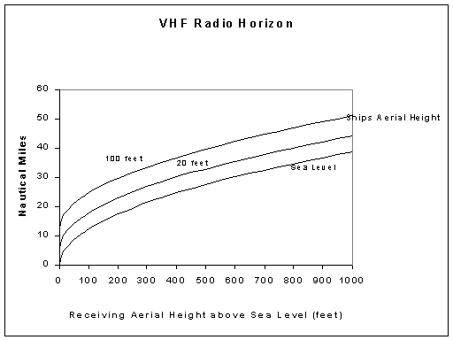
Note the size of the ship makes a considerable difference to the range.
Reception beyond this range is caused by propagation conditions and will be flukey.
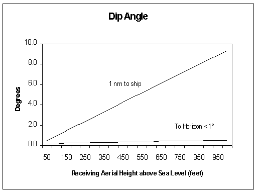
Dip
This was checked to see if a ship could actually be below the aerial horizon.The graph shows the angle down to a ship for different receiving aerial heights. For a ship 1nm from the aerial and the aerial 1000 feet above sea level the angle down would be 10°. From the same aerial the horizon would be under 1°.
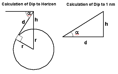
α=Dip angle
To Horizon sin(90-α)=r/(r+h)
To 1 nm tan α=h/d
This significance is high gain collinear aerials increase horizontal gain at the expense of vertical beam width. The graph shows this could be relevant with a high gain aerial close to and much higher than the ship's aerial ie the ship is "below the radar"
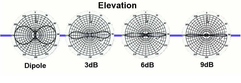
For example the Cushcraft Ringo Ranger specification quotes 7dBi gain and a beam width of 7 degrees. The dipole "donut" becomes a "biscuit" !
For more technical info see the references on my aerial page
See also
Beyond the Horizon Propagation & Tropospheric Ducting Forecast